Vibrant, lush crop fields viewed from a high-angle drone perspective with a digital interface overlay
Precision Intelligence

The Future of Farming is Here

Environmental AI delivers field-level analytics to increase yields, enhance sustainability, and improve bottom-line profitability across your global agricultural portfolio.

See a Field Analysis Demo

From Seed to Harvest, Intelligently

Harnessing the power of multi-spectral satellite imagery and deep learning to redefine modern agribusiness.

Maximize Yields

Our algorithms analyze historical soil data, hyper-local weather patterns, and real-time satellite telemetry to determine optimal planting windows and harvest timing with 95% predictive accuracy.

Efficiency increased by 22% on average.

Optimize Resources

Reduce water and nitrogen waste with prescription application maps down to a per-acre granularity.

Enhance Resilience

Anticipate the impact of drought and heatwaves before they hit, allowing for proactive risk mitigation.

Field-Level Satellite Monitoring

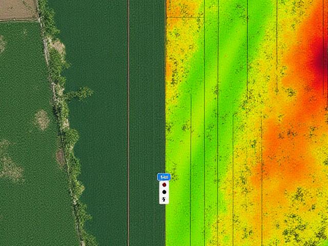
Our platform processes terabytes of multi-spectral satellite imagery to give you a real-time view of crop health, water stress, and soil conditions for every field in your portfolio, accessible from anywhere.

  • NDVI Vegetation Mapping
  • Soil Organic Carbon Tracking
  • Early Pest Detection
Comparison between standard satellite imagery and high-tech NDVI heat maps showing crop health
Interactive NDVI analysis vs. Traditional RGB view.